Classroom example VEERUM
Show your class · 1 of 5
The questionShow your class · 2 of 5
How it worksShow your class · 3 of 5
Who does this workShow your class · 4 of 5
Ways inShow your class · 5 of 5
Ask the classFor you
About VEERUMFor you
SourcesHow do you know a digital model matches the real site?
VEERUM · Calgary headquarters and software-development business; customer assets may be elsewhere.
Where it fits
Pick your class- Science 10 · Scientific inquiry: measurement and model checking
How it works
Schematic · not to scale
Check a model against the site
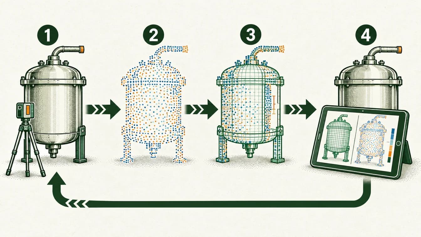
Collect spatial observations of a site.
Organize measurements into a digital representation.
Check alignment, missing areas and observation dates.
Compare with current conditions before using the model for a decision.
Detail is not the same as accuracy. The scene is generic, not a VEERUM customer installation.
The lesson, in the real world
A digital view is useful only if it represents the place reliably.
- 1
A physical site can be captured in measurements and images, while design models describe intended structures.
Our explanation - 2
VEERUM describes combining visual datasets, including point clouds and textured 3D models, with additional asset information.
Our explanation - 3
To compare them meaningfully, users need compatible location references and an understanding of when the information was captured.
Our explanation - 4
A detailed model may still omit an object, contain an alignment error or be out of date. The decision determines how much confidence is needed.
Our explanation
Who does this work
Roles connected to this example
What each kind of work involves, the job titles to look for, and where to find postings in Calgary.
Spatial data and mapping
Turn measurements tied to places into usable spatial information. The work involves coordinates, scale and checking that datasets describe the same location and time.
Classroom connection
Models can be detailed while still containing gaps or misaligned measurements.Job titles to search
GIS technician · GIS analyst · Geomatics technologistWork area · Point-cloud and spatial visualization are documented capabilities; this does not prove VEERUM employs surveyors for every project.Software and data systems
Build the tools that move, process and display information. Reliable software needs testing against missing, delayed and unexpected data as well as ideal examples.
Classroom connection
An algorithm’s output depends on the quality and meaning of its inputs.Job titles to search
Software developer · Data engineerWork area · The product and careers materials support software work areas.Quality and traceability
Make it possible to explain how a result or product was produced. Quality work checks records, methods and acceptance criteria so variation can be investigated rather than hidden.
Classroom connection
Repeated results need both measurements and records of the conditions that produced them.Job titles to search
Quality assurance technician · Quality control analystRelated work · Data checks are an interpreted work area linked to reliable visualization, not a verified quality job title.
Cards distinguish work documented at VEERUM from related work at other employers. Dated accounts and postings are not a current staff roster or a promise of a vacancy.
Ways in
For your students
Ways to prepare for this work
Programs that teach skills this work uses. Each is one route in, not a requirement, and no program has endorsed this page.
SAITDiplomaCalgary
Geomatics Engineering Technology
Learn surveying, GIS, positioning and remote sensing.
About this route
Check the provider’s current prerequisites and intake availability. This is a related learning route, not a hiring promise or an employer requirement.
Why it connects to the work · our interpretation
Spatial data and mappingSupports spatial measurement and mapping data work. Models can be detailed while still containing gaps or misaligned measurements.
SAITDiplomaCalgary
Software Development
Learn to design, test and build software across front-end and back-end systems.
About this route
Check the provider’s current prerequisites and intake availability. This is a related learning route, not a hiring promise or an employer requirement.
Why it connects to the work · our interpretation
Software and data systemsA foundation for junior development or testing; senior roles require further experience. An algorithm’s output depends on the quality and meaning of its inputs.
Spatial data and mappingA foundation for junior development or testing; senior roles require further experience. Models can be detailed while still containing gaps or misaligned measurements.
Quality and traceabilityA foundation for junior development or testing; senior roles require further experience. Repeated results need both measurements and records of the conditions that produced them.
SAITDiplomaCalgary
Mechanical Engineering Technology
Study mechanical systems, design and manufacturing, with specialization options.
About this route
Check the provider’s current prerequisites and intake availability. This is a related learning route, not a hiring promise or an employer requirement.
Why it connects to the work · our interpretation
Quality and traceabilitySupports component design, prototyping and equipment work. Repeated results need both measurements and records of the conditions that produced them.
Ask the class
Use it in class
Ask the class
What would you check before using a digital model to decide whether new equipment will fit?
Give students two fictional site drawings: one is precisely scaled but old, and one is recent but approximate. Ask which decisions each supports and what new measurement would resolve the gap.
Mindset it shows
Accuracy, completeness and freshness are different qualities. More realistic rendering does not guarantee a better measurement.
About VEERUM

A digital view is useful only if it represents the place reliably.
- Headquarters
- Calgary headquarters and software-development business; customer assets may be elsewhere.
- Source: Company and platform(opens in a new tab); Calgary contact(opens in a new tab); 3D data and model capabilities(opens in a new tab); Careers check(opens in a new tab)
- Local connection
- Calgary headquarters and software-development business; customer assets may be elsewhere.
- Source: Company and platform(opens in a new tab); Calgary contact(opens in a new tab); 3D data and model capabilities(opens in a new tab); Careers check(opens in a new tab)
- Team size
- Not verified. We have not found a dated, sourced figure.
- The problem
- How do you know a digital representation is accurate and current enough for a decision?
- Source: Company and platform(opens in a new tab); Calgary contact(opens in a new tab); 3D data and model capabilities(opens in a new tab); Careers check(opens in a new tab)
- What they do
- Industrial visualization and digital-twin software.
- Source: Company and platform(opens in a new tab); Calgary contact(opens in a new tab); 3D data and model capabilities(opens in a new tab); Careers check(opens in a new tab)
- Who uses it
- Asset owners, engineering teams and people collaborating on industrial sites.
- Source: Company and platform(opens in a new tab); Calgary contact(opens in a new tab); 3D data and model capabilities(opens in a new tab); Careers check(opens in a new tab)
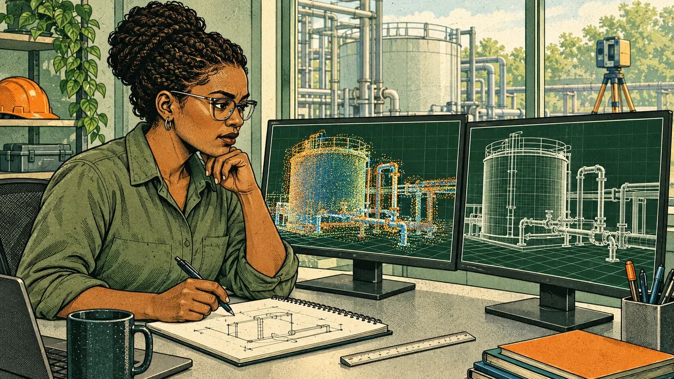
VEERUM is a Calgary-headquartered software company offering visual tools for industrial assets. Its published material describes bringing point clouds, 3D models and additional data together so users can inspect and discuss a site remotely. This story focuses on the relationship between a physical place and its digital representation.
Source: Company and platform(opens in a new tab); Calgary contact(opens in a new tab); 3D data and model capabilities(opens in a new tab); Careers check(opens in a new tab)Read each source’s date and scope: a documented role is not proof of a current vacancy or of where every position is based.
Reported as VEERUM states it. VEERUM has not reviewed or endorsed this page.
Sources and course fit
Sources checked 15 Oct 2026
Where it fits
- Science 10 · Scientific inquiry: measurement and model checking
Editorial mapping to published CBE course topics. Pending educator review. No outcome-code alignment is claimed.
Sources
- SAIT — Software Development(opens in a new tab)
- SAIT — Mechanical Engineering Technology(opens in a new tab)
- Calgary Board of Education: Science 10/20/30 course topics(opens in a new tab)
- SAIT — Geomatics Engineering Technology(opens in a new tab)
- Company and platform(opens in a new tab)
- Calgary contact(opens in a new tab)
- 3D data and model capabilities(opens in a new tab)
- Careers check(opens in a new tab)
- Alberta Science 10 program (government-hosted copy): inquiry skills, pp. 8–10(opens in a new tab)
Organization claims are reported as the organization states them. VEERUM has not reviewed or endorsed this page.
What we know, and how
| Type | Claim | How we know |
|---|---|---|
| work | VEERUM is a Calgary-headquartered software company offering visual tools for industrial assets. Its published material describes bringing point clouds, 3D models and additional data together so users can inspect and discuss a site remotely. This story focuses on the relationship between a physical place and its digital representation.Source: Company and platform; Calgary contact; 3D data and model capabilities; Careers check | Organization-stated |
| local connection | Calgary headquarters and software-development business; customer assets may be elsewhere.Source: Company and platform; Calgary contact; 3D data and model capabilities; Careers check | Organization-stated |
| course fit | A cross-unit inquiry-skills connection: compare a model with observations, identify gaps and judge whether data are fit for a decision. No specific physics unit or digital-twin outcome is claimed.Source: Calgary Board of Education: Science 10/20/30 course topics; Alberta Science 10 program (government-hosted copy): inquiry skills, pp. 8–10 | Editorial connection to verified course topics |
| limits | The capability announcement is dated 2023; do not label it a new feature. A digital twin is not necessarily a real-time or predictive simulation. The current content model only permits Biology, Chemistry or Physics; review the strongest classroom placement before implementation rather than forcing a fit.Source: Company and platform; Calgary contact; 3D data and model capabilities; Careers check | Scope of this example |
Solid green: the organization states it. Outlined: seen in a dated source. Dashed: our interpretation, not yet researched, or announced but not yet real.