Classroom example O2 Planning and Design
Show your class · 1 of 5
The questionShow your class · 2 of 5
How it worksShow your class · 3 of 5
Who does this workShow your class · 4 of 5
Ways inShow your class · 5 of 5
Ask the classFor you
About O2 Planning and DesignFor you
SourcesHow can a park help clean stormwater before it reaches a river?
O2 Planning and Design · Calgary studio; the featured project is Dale Hodges Park in Calgary.
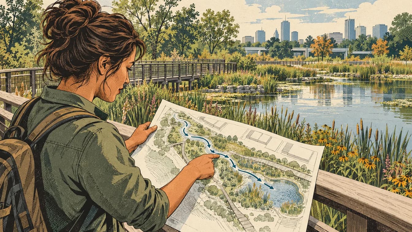
Where it fits
Pick your class- Biology 20 · Water, habitat and ecosystem relationships
How it works
Schematic · not to scale
Follow stormwater through a landscape
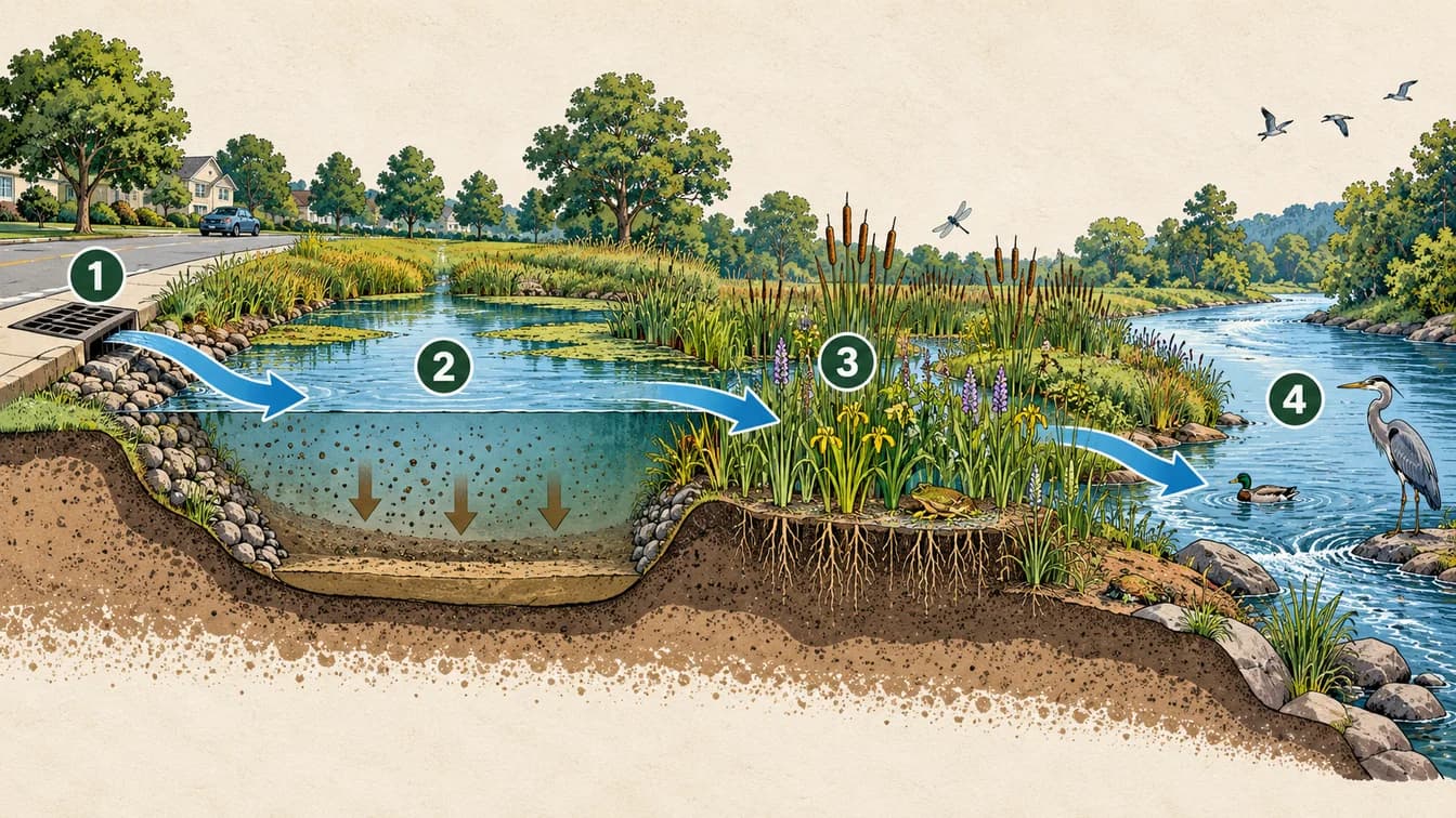
Runoff enters from streets and drains.
Slower flow allows some suspended particles to settle.
Water moves through a planted marsh.
The downstream river and habitat remain part of the system.
A conceptual route, not an engineering plan. Clearer water can still contain dissolved substances; no drinking-water quality is implied.
The lesson, in the real world
A park can be part of a city’s water system.
- 1
Runoff carries water and suspended material from streets into drainage systems.
Our explanation - 2
At Dale Hodges Park, water follows a designed route through a landscape rather than remaining hidden in pipes.
Our explanation - 3
Slower flow can allow some suspended particles to settle. Different treatment stages address different parts of the problem.
Our explanation - 4
The landscape also supports habitat and recreation. A useful design must account for these needs together.
Our explanation
Who does this work
Role
Spatial data and mapping
Turn measurements tied to places into usable spatial information. The work involves coordinates, scale and checking that datasets describe the same location and time.
What might you actually do?
Investigate
Check coordinate systems and measurement dates.
Test and compare
Align and inspect spatial datasets.
Explain and improve
Present maps or models with their limitations.
Typical of this kind of work in general. Not a description of any one person’s job at O2 Planning and Design.
- Often works with
- Surveyors, engineers, field operators and software teams
- Classroom connection
- Models can be detailed while still containing gaps or misaligned measurements.
Related job postings
Similar work at other employers in Calgary, AB, not openings at O2 Planning and Design. These are live searches: results change daily and we have not checked them.
- GIS technicianIndeed search for GIS technician (opens in a new tab)Job Bank search for GIS technician (opens in a new tab)
- GIS analystIndeed search for GIS analyst (opens in a new tab)Job Bank search for GIS analyst (opens in a new tab)
- Geomatics technologistIndeed search for Geomatics technologist (opens in a new tab)Job Bank search for Geomatics technologist (opens in a new tab)
How to prepare
Geomatics Engineering Technology
SAIT
Ways in
For your students
Ways to prepare for this work
Programs that teach skills this work uses. Each is one route in, not a requirement, and no program has endorsed this page.
Showing routes for spatial data and mapping. Show all
SAITDiplomaCalgary
Geomatics Engineering Technology
Learn surveying, GIS, positioning and remote sensing.
About this route
Check the provider’s current prerequisites and intake availability. This is a related learning route, not a hiring promise or an employer requirement.
Why it connects to the work · our interpretation
Spatial data and mappingSupports spatial measurement and mapping data work. Models can be detailed while still containing gaps or misaligned measurements.
Ask the class
Use it in class
Ask the class
Would the clearest-looking water necessarily be the safest water?
Draw two fictional routes from a street drain to a river: one short and fast, one with space for settling. Mark where to sample and one habitat trade-off.
Mindset it shows
Clear water can still contain dissolved contaminants. This is a planning model, not a drinking-water treatment demonstration.
About O2 Planning and Design

A park can be part of a city’s water system.
- Headquarters
- Headquarters not separately verified for this example.
- Local connection
- Calgary studio; the featured project is Dale Hodges Park in Calgary.
- Source: O2 Planning and Design — company/project evidence 1(opens in a new tab); O2 Planning and Design — company/project evidence 2(opens in a new tab); O2 Planning and Design — company/project evidence 3(opens in a new tab); O2 Planning and Design — company/project evidence 4(opens in a new tab); O2 Planning and Design — company/project evidence 5(opens in a new tab)
- Team size
- Not verified. We have not found a dated, sourced figure.
- The problem
- How can a park help clean stormwater before it reaches a river?
- Source: O2 Planning and Design — company/project evidence 1(opens in a new tab); O2 Planning and Design — company/project evidence 2(opens in a new tab); O2 Planning and Design — company/project evidence 3(opens in a new tab); O2 Planning and Design — company/project evidence 4(opens in a new tab); O2 Planning and Design — company/project evidence 5(opens in a new tab)
- What they do
- Landscape architecture, planning and spatial analysis, including stormwater landscapes.
- Source: O2 Planning and Design — company/project evidence 1(opens in a new tab); O2 Planning and Design — company/project evidence 2(opens in a new tab); O2 Planning and Design — company/project evidence 3(opens in a new tab); O2 Planning and Design — company/project evidence 4(opens in a new tab); O2 Planning and Design — company/project evidence 5(opens in a new tab)
- Who uses it
- Municipal project teams and the people who use parks and nearby waterways.
- Source: O2 Planning and Design — company/project evidence 1(opens in a new tab); O2 Planning and Design — company/project evidence 2(opens in a new tab); O2 Planning and Design — company/project evidence 3(opens in a new tab); O2 Planning and Design — company/project evidence 4(opens in a new tab); O2 Planning and Design — company/project evidence 5(opens in a new tab)
O2 is a planning and design practice with a Calgary studio. At Dale Hodges Park, it worked with other specialists to combine stormwater treatment, habitat and public space. Its project account describes marshes, wet meadows and landforms that guide water before it reaches the Bow River. This was collaborative work; O2 did not design every element alone.
Source: O2 Planning and Design — company/project evidence 1(opens in a new tab); O2 Planning and Design — company/project evidence 2(opens in a new tab); O2 Planning and Design — company/project evidence 3(opens in a new tab); O2 Planning and Design — company/project evidence 4(opens in a new tab); O2 Planning and Design — company/project evidence 5(opens in a new tab)Read each source’s date and scope: a documented role is not proof of a current vacancy or of where every position is based.
Reported as O2 Planning and Design states it. O2 Planning and Design has not reviewed or endorsed this page.
Sources and course fit
Sources checked 17 Oct 2026
Where it fits
- Biology 20 · Water, habitat and ecosystem relationships
Editorial mapping to published CBE course topics. Pending educator review. No outcome-code alignment is claimed.
Sources
- O2 Planning and Design — company/project evidence 1(opens in a new tab)
- O2 Planning and Design — company/project evidence 2(opens in a new tab)
- O2 Planning and Design — company/project evidence 3(opens in a new tab)
- O2 Planning and Design — company/project evidence 4(opens in a new tab)
- O2 Planning and Design — company/project evidence 5(opens in a new tab)
- Alberta Biology 20–30 program: water use and ecosystems(opens in a new tab)
- University of Calgary — Master of Landscape Architecture(opens in a new tab)
- SAIT — Geomatics Engineering Technology(opens in a new tab)
- SAIT — Environmental Technology(opens in a new tab)
Organization claims are reported as the organization states them. O2 Planning and Design has not reviewed or endorsed this page.
What we know, and how
| Type | Claim | How we know |
|---|---|---|
| work | O2 is a planning and design practice with a Calgary studio. At Dale Hodges Park, it worked with other specialists to combine stormwater treatment, habitat and public space. Its project account describes marshes, wet meadows and landforms that guide water before it reaches the Bow River. This was collaborative work; O2 did not design every element alone.Source: O2 Planning and Design — company/project evidence 1; O2 Planning and Design — company/project evidence 2; O2 Planning and Design — company/project evidence 3; O2 Planning and Design — company/project evidence 4; O2 Planning and Design — company/project evidence 5 | Source-backed company/project account |
| local connection | Calgary studio; the featured project is Dale Hodges Park in Calgary.Source: O2 Planning and Design — company/project evidence 1; O2 Planning and Design — company/project evidence 2; O2 Planning and Design — company/project evidence 3; O2 Planning and Design — company/project evidence 4; O2 Planning and Design — company/project evidence 5 | Source-backed local work |
| course fit | Biology 20 B1.3k relates biotic and abiotic factors in aquatic ecosystems. Use the park to compare habitat and water conditions; treatment performance needs measurements.Source: Alberta Biology 20–30 program: water use and ecosystems | Editorial application of verified curriculum topics |
| limits | No measured removal percentage is claimed. Preserve partner attribution and distinguish suspended particles from dissolved substances.Source: O2 Planning and Design — company/project evidence 1; O2 Planning and Design — company/project evidence 2; O2 Planning and Design — company/project evidence 3; O2 Planning and Design — company/project evidence 4; O2 Planning and Design — company/project evidence 5 | Scope of this example |
Solid green: the organization states it. Outlined: seen in a dated source. Dashed: our interpretation, not yet researched, or announced but not yet real.