Classroom example ISL Engineering
Show your class · 1 of 5
The questionShow your class · 2 of 5
How it worksShow your class · 3 of 5
Who does this workShow your class · 4 of 5
Ways inShow your class · 5 of 5
Ask the classFor you
About ISL EngineeringFor you
SourcesHow can a road cross a creek without ignoring the landscape?
ISL Engineering · The featured road, creek crossing and pathways are in Calgary; ISL identifies the City as client.
Where it fits
Pick your class- Biology 20 · Aquatic ecosystems and environmental evidence
How it works
Schematic · not to scale
Design a crossing with its landscape in view

Observe terrain, water and habitat.
Compare routes and their constraints.
Coordinate the road, pathway and creek crossing.
Check conditions and monitor the affected landscape.
A generic crossing, not the actual 144 Avenue design. Monitoring is needed to establish environmental outcomes; a design intention is not a measured result.
The lesson, in the real world
A route has to work for people and for the ground and water beneath it.
- 1
Map the terrain, existing connections and watercourse before drawing a route.
Our explanation - 2
Compare options for gradients, crossings and access. A change in one constraint can affect another.
Our explanation - 3
Bring transportation, structural, water and environmental expertise together to develop the design.
Our explanation - 4
Check the built corridor against its intended function and monitor the landscape it affects. Design intent is not a measured ecological outcome.
Our explanation
Who does this work
Role
Spatial data and mapping
Turn measurements tied to places into usable spatial information. The work involves coordinates, scale and checking that datasets describe the same location and time.
What might you actually do?
Investigate
Check coordinate systems and measurement dates.
Test and compare
Align and inspect spatial datasets.
Explain and improve
Present maps or models with their limitations.
Typical of this kind of work in general. Not a description of any one person’s job at ISL Engineering.
- Often works with
- Surveyors, engineers, field operators and software teams
- Classroom connection
- Models can be detailed while still containing gaps or misaligned measurements.
Related job postings
Similar work at other employers in Calgary, AB, not openings at ISL Engineering. These are live searches: results change daily and we have not checked them.
- GIS technicianIndeed search for GIS technician (opens in a new tab)Job Bank search for GIS technician (opens in a new tab)
- GIS analystIndeed search for GIS analyst (opens in a new tab)Job Bank search for GIS analyst (opens in a new tab)
- Geomatics technologistIndeed search for Geomatics technologist (opens in a new tab)Job Bank search for Geomatics technologist (opens in a new tab)
How to prepare
Geomatics Engineering Technology
SAIT
Ways in
For your students
Ways to prepare for this work
Programs that teach skills this work uses. Each is one route in, not a requirement, and no program has endorsed this page.
Showing routes for spatial data and mapping. Show all
SAITDiplomaCalgary
Geomatics Engineering Technology
Learn surveying, GIS, positioning and remote sensing.
About this route
Check the provider’s current prerequisites and intake availability. This is a related learning route, not a hiring promise or an employer requirement.
Why it connects to the work · our interpretation
Spatial data and mappingSupports spatial measurement and mapping data work. Models can be detailed while still containing gaps or misaligned measurements.
Ask the class
Use it in class
Ask the class
Why might the shortest route be a poor design?
Choose between two fictional corridors: one is shorter but steep and crosses a creek twice; one is longer and crosses once. List evidence needed before selecting either, without inventing a numerical score.
Mindset it shows
The exercise is not the actual route evaluation. No claim that the real creek project had a measured biodiversity improvement is made.
About ISL Engineering

A route has to work for people and for the ground and water beneath it.
- Headquarters
- Headquarters not separately verified for this example.
- Local connection
- The featured road, creek crossing and pathways are in Calgary; ISL identifies the City as client.
- Source: ISL Engineering — company/project evidence 1(opens in a new tab); ISL Engineering — company/project evidence 2(opens in a new tab); ISL Engineering — company/project evidence 3(opens in a new tab); ISL Engineering — company/project evidence 4(opens in a new tab)
- Team size
- Not verified. We have not found a dated, sourced figure.
- The problem
- How can a road cross a creek without ignoring the landscape?
- Source: ISL Engineering — company/project evidence 1(opens in a new tab); ISL Engineering — company/project evidence 2(opens in a new tab); ISL Engineering — company/project evidence 3(opens in a new tab); ISL Engineering — company/project evidence 4(opens in a new tab)
- What they do
- Infrastructure planning, engineering and construction support, including Calgary’s 144 Avenue NW extension.
- Source: ISL Engineering — company/project evidence 1(opens in a new tab); ISL Engineering — company/project evidence 2(opens in a new tab); ISL Engineering — company/project evidence 3(opens in a new tab); ISL Engineering — company/project evidence 4(opens in a new tab)
- Who uses it
- Municipal project teams and people travelling through the completed corridor.
- Source: ISL Engineering — company/project evidence 1(opens in a new tab); ISL Engineering — company/project evidence 2(opens in a new tab); ISL Engineering — company/project evidence 3(opens in a new tab); ISL Engineering — company/project evidence 4(opens in a new tab)
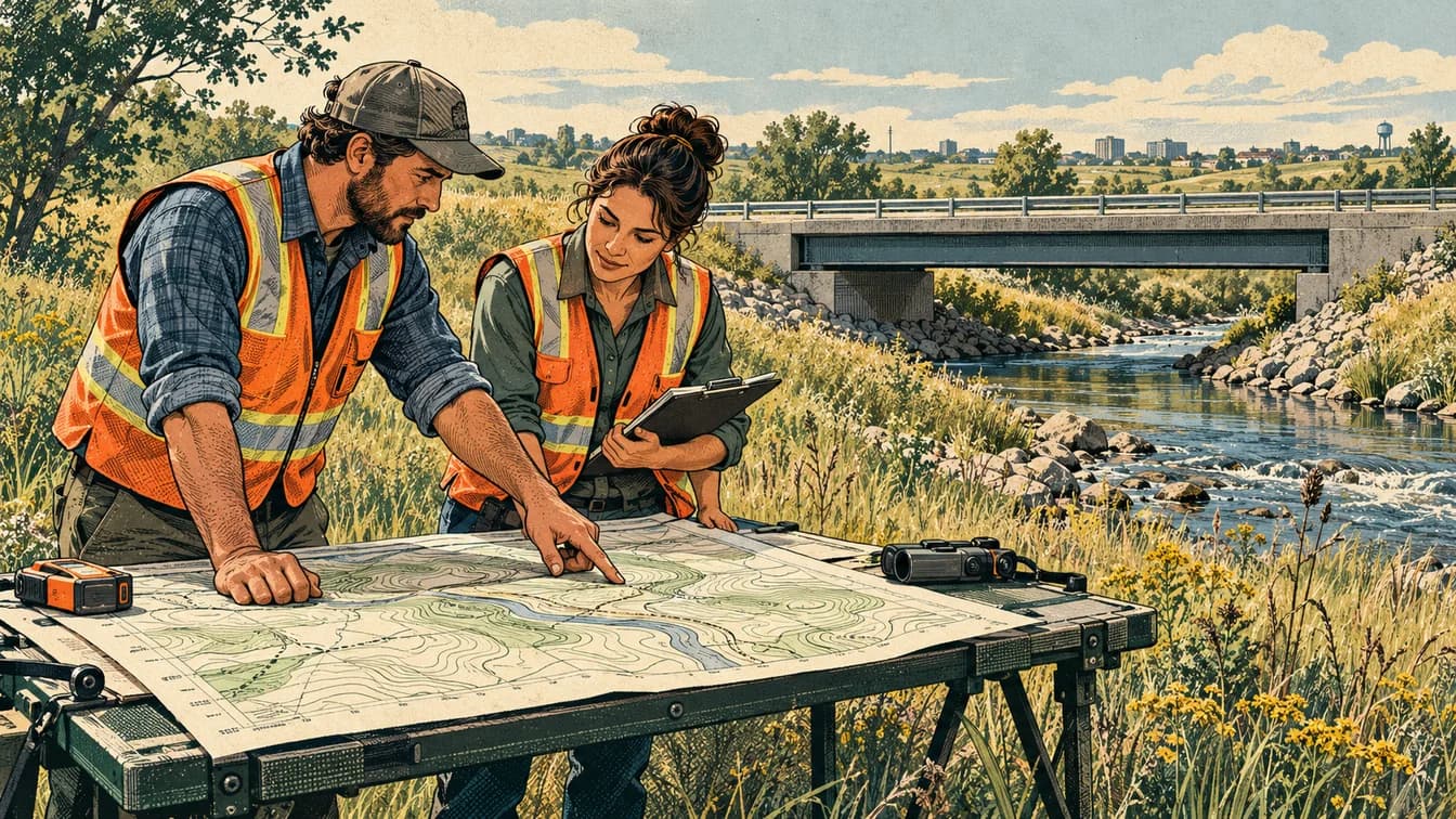
ISL was the City of Calgary’s prime consultant for planning, detailed design and construction work on the 144 Avenue NW extension. Its project account describes steep terrain, a single-span bridge over West Nose Creek, creek work and multi-use pathways. This creates a local example of design constraints interacting, rather than a story about choosing the shortest line on a map.
Source: ISL Engineering — company/project evidence 1(opens in a new tab); ISL Engineering — company/project evidence 2(opens in a new tab); ISL Engineering — company/project evidence 3(opens in a new tab); ISL Engineering — company/project evidence 4(opens in a new tab)Read each source’s date and scope: a documented role is not proof of a current vacancy or of where every position is based.
Reported as ISL Engineering states it. ISL Engineering has not reviewed or endorsed this page.
Sources and course fit
Sources checked 17 Oct 2026
Where it fits
- Biology 20 · Aquatic ecosystems and environmental evidence
Editorial mapping to published CBE course topics. Pending educator review. No outcome-code alignment is claimed.
Sources
- Alberta Biology 20–30 program: water use and ecosystems(opens in a new tab)
- SAIT — Geomatics Engineering Technology(opens in a new tab)
- SAIT — Environmental Technology(opens in a new tab)
- University of Calgary — Civil Engineering(opens in a new tab)
- SAIT — Civil Engineering Technology, Municipal Major(opens in a new tab)
- ISL Engineering — company/project evidence 1(opens in a new tab)
- ISL Engineering — company/project evidence 2(opens in a new tab)
- ISL Engineering — company/project evidence 3(opens in a new tab)
- ISL Engineering — company/project evidence 4(opens in a new tab)
Organization claims are reported as the organization states them. ISL Engineering has not reviewed or endorsed this page.
What we know, and how
| Type | Claim | How we know |
|---|---|---|
| work | ISL was the City of Calgary’s prime consultant for planning, detailed design and construction work on the 144 Avenue NW extension. Its project account describes steep terrain, a single-span bridge over West Nose Creek, creek work and multi-use pathways. This creates a local example of design constraints interacting, rather than a story about choosing the shortest line on a map.Source: ISL Engineering — company/project evidence 1; ISL Engineering — company/project evidence 2; ISL Engineering — company/project evidence 3; ISL Engineering — company/project evidence 4 | Source-backed company/project account |
| local connection | The featured road, creek crossing and pathways are in Calgary; ISL identifies the City as client.Source: ISL Engineering — company/project evidence 1; ISL Engineering — company/project evidence 2; ISL Engineering — company/project evidence 3; ISL Engineering — company/project evidence 4 | Source-backed local work |
| course fit | Biology 20 B1.3k connects biotic and abiotic characteristics of aquatic ecosystems. Compare creek habitat and water observations before and after a crossing; road geometry is context rather than a claimed kinematics outcome.Source: Alberta Biology 20–30 program: water use and ecosystems | Editorial application of verified curriculum topics |
| limits | Question narrowed from a generic safe route to the documented creek/terrain problem. Keep Indigenous engagement claims out unless specifically sourced and contextualized.Source: ISL Engineering — company/project evidence 1; ISL Engineering — company/project evidence 2; ISL Engineering — company/project evidence 3; ISL Engineering — company/project evidence 4 | Scope of this example |
Solid green: the organization states it. Outlined: seen in a dated source. Dashed: our interpretation, not yet researched, or announced but not yet real.