Classroom example AERIUM Analytics
Show your class · 1 of 5
The questionShow your class · 2 of 5
How it worksShow your class · 3 of 5
Who does this workShow your class · 4 of 5
Ways inShow your class · 5 of 5
Ask the classFor you
About AERIUM AnalyticsFor you
SourcesCan a bird-shaped drone help reduce airport wildlife hazards?
AERIUM Analytics · Calgary head office; the cited airport deployment is outside Calgary.
Where it fits
Pick your class- Biology 20 · Ecosystems, populations and observation
How it works
Schematic · not to scale
Observe, intervene, then measure again
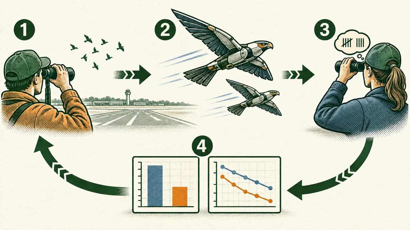
Record bird activity before intervention.
Use the bird-shaped drone as one part of site management.
Continue observations after the intervention.
Compare results and consider other explanations.
The charts are fictional, not measured results. The arrows show an evaluation plan, not a guaranteed effect. The cited airport deployment is outside Calgary.
The lesson, in the real world
An animal’s response can become part of an engineering design.
- 1
Birds near an airport can create conflicts with aircraft operations. Site teams need to understand where and when birds are present.
Our explanation - 2
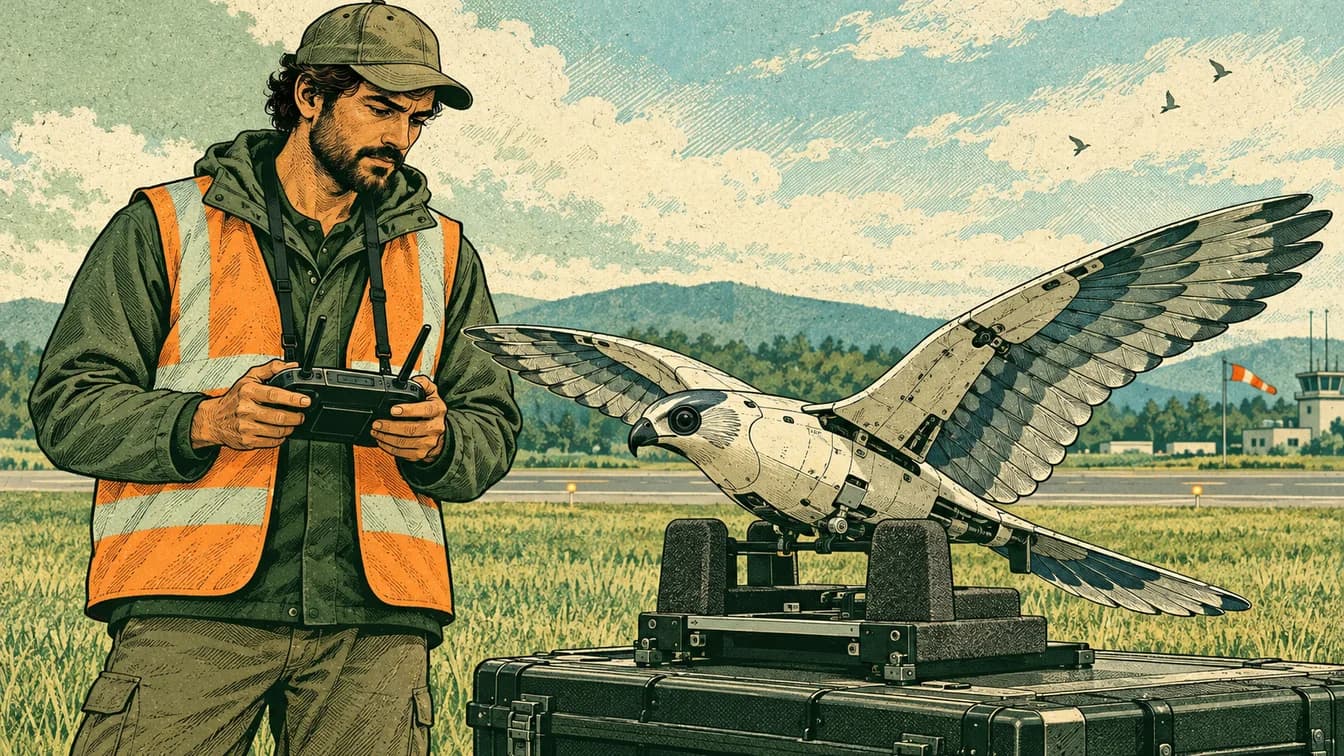
AERIUM describes RoBird as a falcon-like drone intended to create a deterrence response.
Our explanation - 3
Operators coordinate flights with site personnel and observe how birds respond. The drone is one part of a management approach.
Our explanation - 4
Compare bird activity and safety outcomes over time while accounting for season, weather and other interventions. A short-term response is not proof of a permanent effect.
Our explanation
Who does this work
Role
Spatial data and mapping
Turn measurements tied to places into usable spatial information. The work involves coordinates, scale and checking that datasets describe the same location and time.
What might you actually do?
Investigate
Check coordinate systems and measurement dates.
Test and compare
Align and inspect spatial datasets.
Explain and improve
Present maps or models with their limitations.
Typical of this kind of work in general. Not a description of any one person’s job at AERIUM Analytics.
- Often works with
- Surveyors, engineers, field operators and software teams
- Classroom connection
- Models can be detailed while still containing gaps or misaligned measurements.
Related job postings
Similar work at other employers in Calgary, AB, not openings at AERIUM Analytics. These are live searches: results change daily and we have not checked them.
- GIS technicianIndeed search for GIS technician (opens in a new tab)Job Bank search for GIS technician (opens in a new tab)
- GIS analystIndeed search for GIS analyst (opens in a new tab)Job Bank search for GIS analyst (opens in a new tab)
- Geomatics technologistIndeed search for Geomatics technologist (opens in a new tab)Job Bank search for Geomatics technologist (opens in a new tab)
How to prepare
Geomatics Engineering Technology
SAIT
Software Development
SAIT
Ways in
For your students
Ways to prepare for this work
Programs that teach skills this work uses. Each is one route in, not a requirement, and no program has endorsed this page.
Showing routes for spatial data and mapping. Show all
SAITDiplomaCalgary
Geomatics Engineering Technology
Learn surveying, GIS, positioning and remote sensing.
About this route
Check the provider’s current prerequisites and intake availability. This is a related learning route, not a hiring promise or an employer requirement.
Why it connects to the work · our interpretation
Spatial data and mappingSupports spatial measurement and mapping data work. Models can be detailed while still containing gaps or misaligned measurements.
SAITDiplomaCalgary
Software Development
Learn to design, test and build software across front-end and back-end systems.
About this route
Check the provider’s current prerequisites and intake availability. This is a related learning route, not a hiring promise or an employer requirement.
Why it connects to the work · our interpretation
Spatial data and mappingA foundation for junior development or testing; senior roles require further experience. Models can be detailed while still containing gaps or misaligned measurements.
Ask the class
Use it in class
Ask the class
How could you tell whether fewer birds were caused by the intervention or by seasonal migration?
Create a comparison plan using fictional weekly bird counts at two sites. Ask students which additional variables they would record and why a single before-and-after count is weak evidence.
Mindset it shows
No actual wildlife disturbance or drone flight is part of this activity. Counts are fictional; do not adopt the company’s percentage claims as experimental results.
About AERIUM Analytics

An animal’s response can become part of an engineering design.
- Headquarters
- Calgary head office; the cited airport deployment is outside Calgary.
- Source: RoBird design and airport example(opens in a new tab); Operational tasks(opens in a new tab); Services and stakeholders(opens in a new tab); Calgary connection(opens in a new tab)
- Local connection
- Calgary head office; the cited airport deployment is outside Calgary.
- Source: RoBird design and airport example(opens in a new tab); Operational tasks(opens in a new tab); Services and stakeholders(opens in a new tab); Calgary connection(opens in a new tab)
- Team size
- Not verified. We have not found a dated, sourced figure.
- The problem
- Can a controlled wildlife response help reduce conflict around an airport?
- Source: RoBird design and airport example(opens in a new tab); Operational tasks(opens in a new tab); Services and stakeholders(opens in a new tab); Calgary connection(opens in a new tab)
- What they do
- Drone operations, wildlife-management services and spatial-data services.
- Source: RoBird design and airport example(opens in a new tab); Operational tasks(opens in a new tab); Services and stakeholders(opens in a new tab); Calgary connection(opens in a new tab)
- Who uses it
- Airport and site operators managing wildlife interactions and operational risks.
- Source: RoBird design and airport example(opens in a new tab); Operational tasks(opens in a new tab); Services and stakeholders(opens in a new tab); Calgary connection(opens in a new tab)
AERIUM Analytics is a Calgary-based drone-services company. Its RoBird system is designed to mimic a predatory bird to influence the behaviour of other birds. The company describes applications at airports and other sites, and identifies work with Edmonton International Airport. Calgary is the company connection; the airport example is in the Edmonton region.
Source: RoBird design and airport example(opens in a new tab); Operational tasks(opens in a new tab); Services and stakeholders(opens in a new tab); Calgary connection(opens in a new tab)Read each source’s date and scope: a documented role is not proof of a current vacancy or of where every position is based.
Reported as AERIUM Analytics states it. AERIUM Analytics has not reviewed or endorsed this page.
Sources and course fit
Sources checked 15 Oct 2026
Where it fits
- Biology 20 · Ecosystems, populations and observation
Editorial mapping to published CBE course topics. Pending educator review. No outcome-code alignment is claimed.
Sources
- SAIT — Software Development(opens in a new tab)
- SAIT — Mechanical Engineering Technology(opens in a new tab)
- Calgary Board of Education: Biology 20/30 course topics(opens in a new tab)
- RoBird design and airport example(opens in a new tab)
- Operational tasks(opens in a new tab)
- Services and stakeholders(opens in a new tab)
- Calgary connection(opens in a new tab)
- SAIT — Geomatics Engineering Technology(opens in a new tab)
Organization claims are reported as the organization states them. AERIUM Analytics has not reviewed or endorsed this page.
What we know, and how
| Type | Claim | How we know |
|---|---|---|
| work | AERIUM Analytics is a Calgary-based drone-services company. Its RoBird system is designed to mimic a predatory bird to influence the behaviour of other birds. The company describes applications at airports and other sites, and identifies work with Edmonton International Airport. Calgary is the company connection; the airport example is in the Edmonton region.Source: RoBird design and airport example; Operational tasks; Services and stakeholders; Calgary connection | Organization-stated |
| local connection | Calgary head office; the cited airport deployment is outside Calgary.Source: RoBird design and airport example; Operational tasks; Services and stakeholders; Calgary connection | Organization-stated |
| course fit | Compare bird observations before and after intervention, with season and weather as competing explanations. A behavioural response alone does not prove population change.Source: Calgary Board of Education: Biology 20/30 course topics | Editorial connection to verified course topics |
| limits | Do not turn humane/no-harm marketing into an independently verified guarantee. No drone qualification or operating permission is conferred by the listed pathways. Exact efficacy estimates are omitted because a suitable controlled evaluation was not established.Source: RoBird design and airport example; Operational tasks; Services and stakeholders; Calgary connection | Scope of this example |
Solid green: the organization states it. Outlined: seen in a dated source. Dashed: our interpretation, not yet researched, or announced but not yet real.